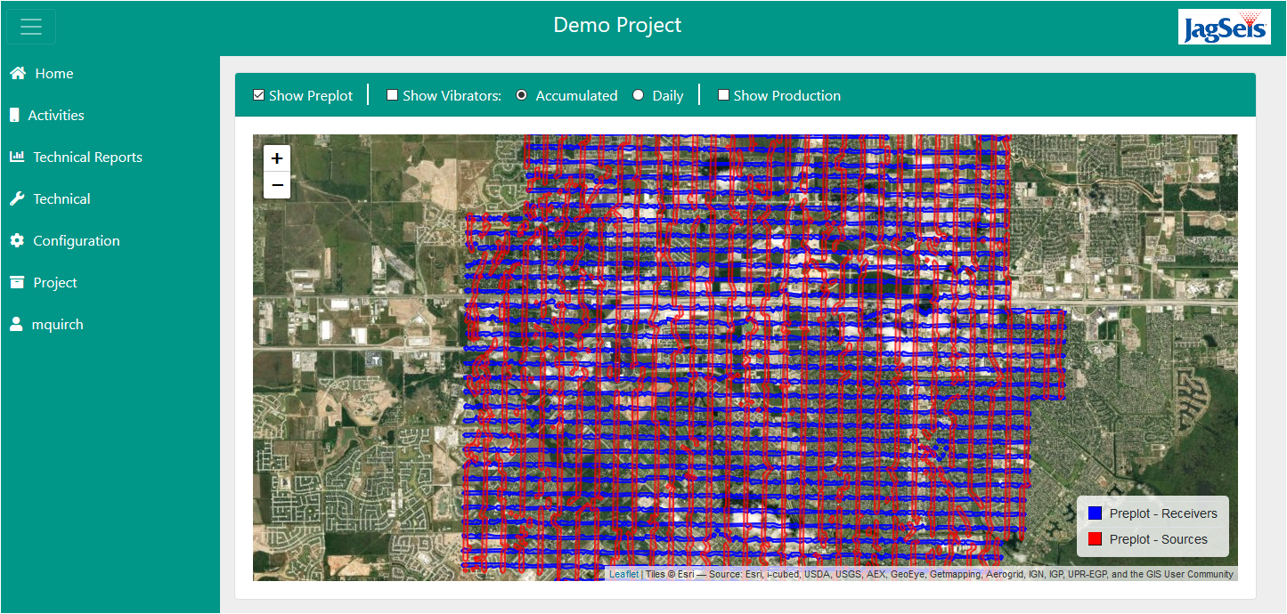
JagSeis® (US patent number 8,694,260 B1), is a web-based data management software application for our Quality Control consultants and clients to monitor all phases of seismic data acquisition projects:
- Supervision and Acquisition QC (AQC) is primarily involved with seismic data acquisition operations and technical compliance.
- Geodetics QC (GQC) is associated with field positioning of all points, plus line clearing.
- Health, Safety and Environment (HSE) addresses all phases of the seismic field operation from an HSE perspective.

Compliance
JagSeis® was developed based on international industry guidelines and best practices. This software application can securely analyze, evaluate, send, receive and archive critical field operations data via the Internet.
Provides a comprehensive software application system for our consultants and clients to track and monitor the progress of seismic projects, anytime from anywhere, for more timely and effective management decisions.
Benefits
- Reliable, validated and integrated seismic project information easily interfaceable with Client’s corporate systems
- Management and control of the entire seismic project from one location:
- Compliance with contract specifications
- 24-hour data viewing
- Contractors’ performance
- Promote client’s HSE-MS standards
- Liaise, support and supervise remote personnel
- Track QCs’ performance
- Proof of performed activities
- Effective quality control results from:
- Integrated information readily available for timely decisions
- Systematic approach with established procedures and guidelines
- Reduced errors by replacing manual data input with digital capture
- Built-in QC tools
- Semi-automatically generated reports
- Compensating for different professional backgrounds
Features
- Displays pre-plots and generates post-plot maps and production statistics for surveying and acquisition (planned vs. actual production)
- Displays data captured with hand-held GPS units (date and time stamp; line and station number, as well as location by X-Y coordinates, where the QC inspection was performed)
- Quality Control for surveying & positioning:
- Tracks and displays offsets, skips and recovered source points
- Tracks and identifies out of specification source and receiver locations
- Helps the field QC to identify survey network monuments and horizontal and vertical accuracy limits
- Helps the field QC to identify positioning errors and equipment errors by using the Query Analyzer (PDOP, # of Satellites, etc.)
- Quality Control for Acquisition:
- Instrument Analysis and Audits based on contractual and manufacturers’ specifications
- Equipment and Explosives Inventory management
- Interface with cable and nodes recording system
- Drilling Performance (shot hole depth)
- Reads the ADSTA files (Trace and Shot Domain Attributes). Identifies defective channels
- Vibrator performance (maps of distortion, phase, force, etc)
- Up-hole time monitoring
- Generates fold plots. Allows the QC to follow acquisition progress to make sure that Nominal Fold will be obtained
- Generates Rose Diagrams: Fold and Offset (Distance and Azimuth) distribution
- Tracks helicopter statistics
- Populates and generates pre-configured daily and weekly report templates and assists in compilation of graphs, tables and displays for monthly and final reports
- Quality Control for HSE:
- Dynamic and unique “HSE EYE” for effective visual tracking of the HSE Management System
- Online review and daily graphics of HSE-MS performance for seismic projects
- Notifications/Alerts for agreed upon critical elements
- Based on industry standards and best practices
- Compliance with governmental regulations
- Inspections and Audits for prevention of incidents
- Corrective Actions and Incident management
- Tracking of Key Performance Indicators
- Location, date/time and inspection data of camps, helipads and other physical sites can easily be gathered with hand-held GPS/digital camera units and effectively displayed on maps


